
-


Data Fusion Engine
-

Operational Tools
-

Planning Tools
-

Data Sharing Portal
-

Research Tools
-

Traveler Information
Data Fusion Engine
Integrates travel time data from various sources into a standard defined linkset
Probe Data, GPS Data, BlueTooth, Sensys Pucks Sensors, RFID Toll Tag
Integrates incident, construction and special event data from various government sources via API integration
Real-time, Planned
Integrates parking data from various sources via API integration
Real-time Status and Occupancy
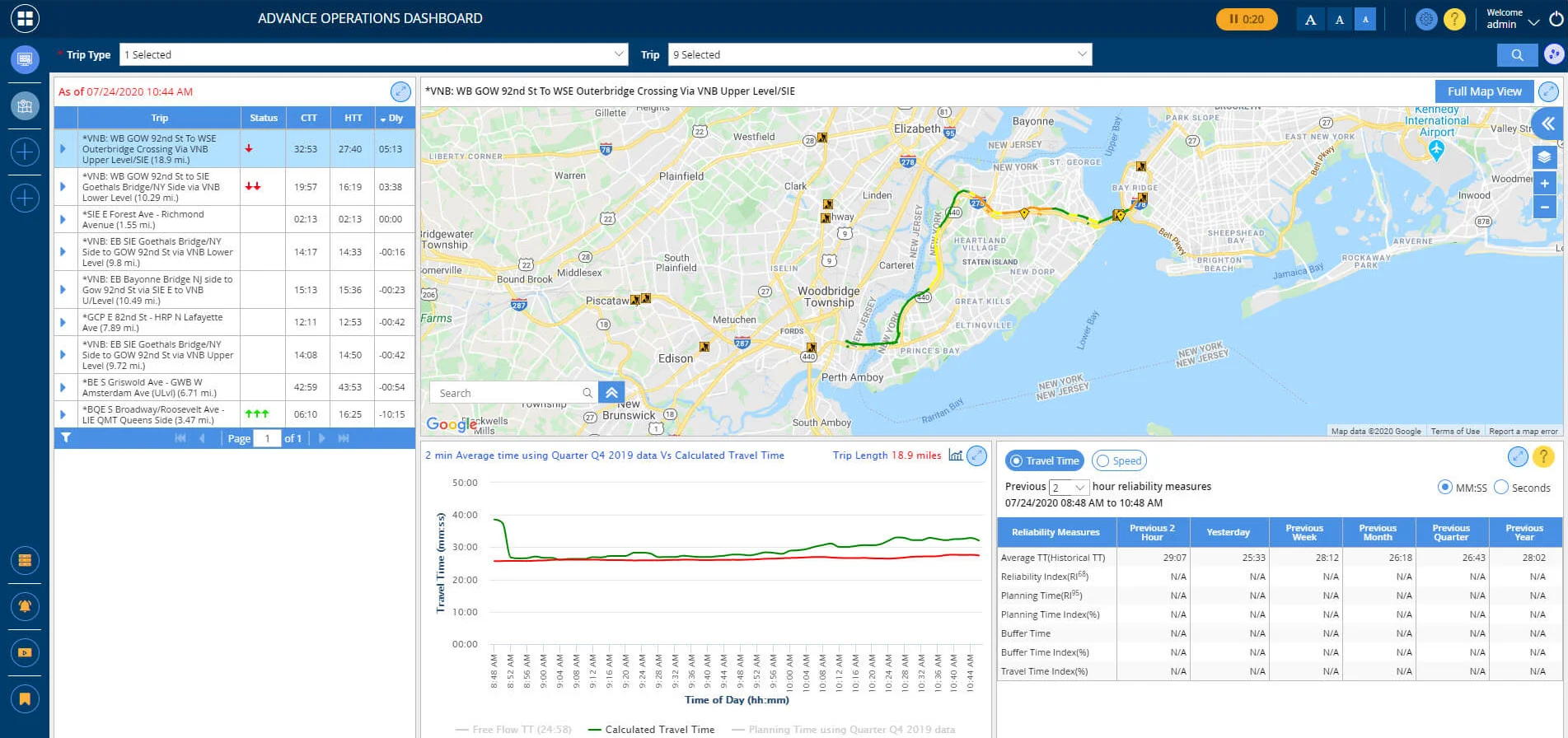
Advanced Operations Dashboard
Advance Operations Dashboard is an application where a user can see trip data analysis and current conditions of roadways caused by construction events. It contains real-time, as well as, historical travel time information for trips. Users can view trips, cameras, and events on a map etc. It also includes features like viewing travel time for selected trips.
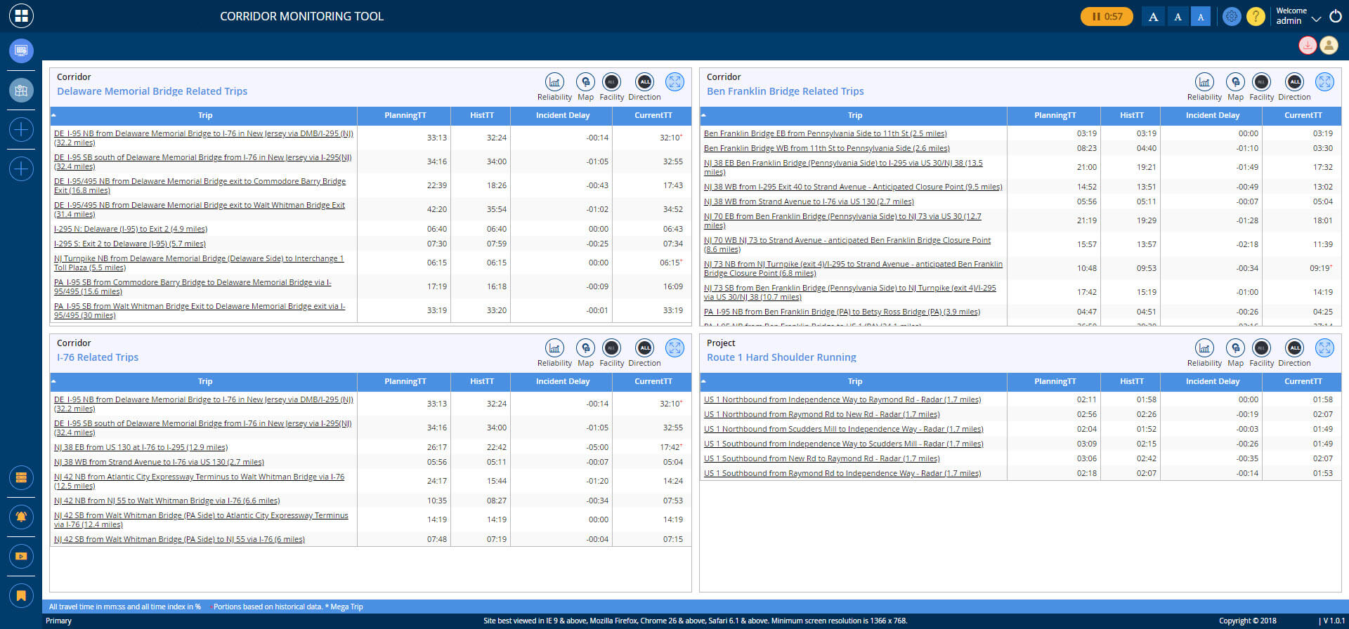
Corridor Viewer
The Corridor Viewer tool provides real time performance data on current conditions for specific corridors. Multiple corridors along different roads can be incorporated into the viewer. It contains real-time, as well as, historical travel time information for trips. They also provide metrics for Reliability, Planning Travel Time, Incident Delay and more.
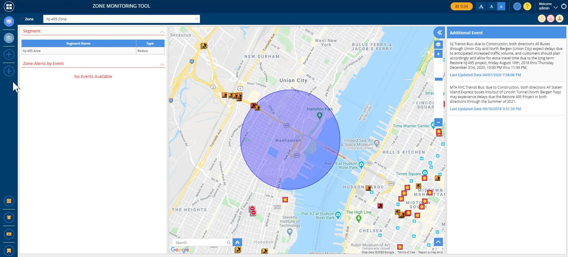
Zone Viewer
The Zone View provides real time conditions in a defined area. The tool displays a map, which shows the location of events and incidents, and congestion levels on roadways. It contains real-time, as well as, historical travel time information for trips. The Zone View can be configured to send an email alert to designated individuals when a planned construction project has transitioned to active status within a defined zone.
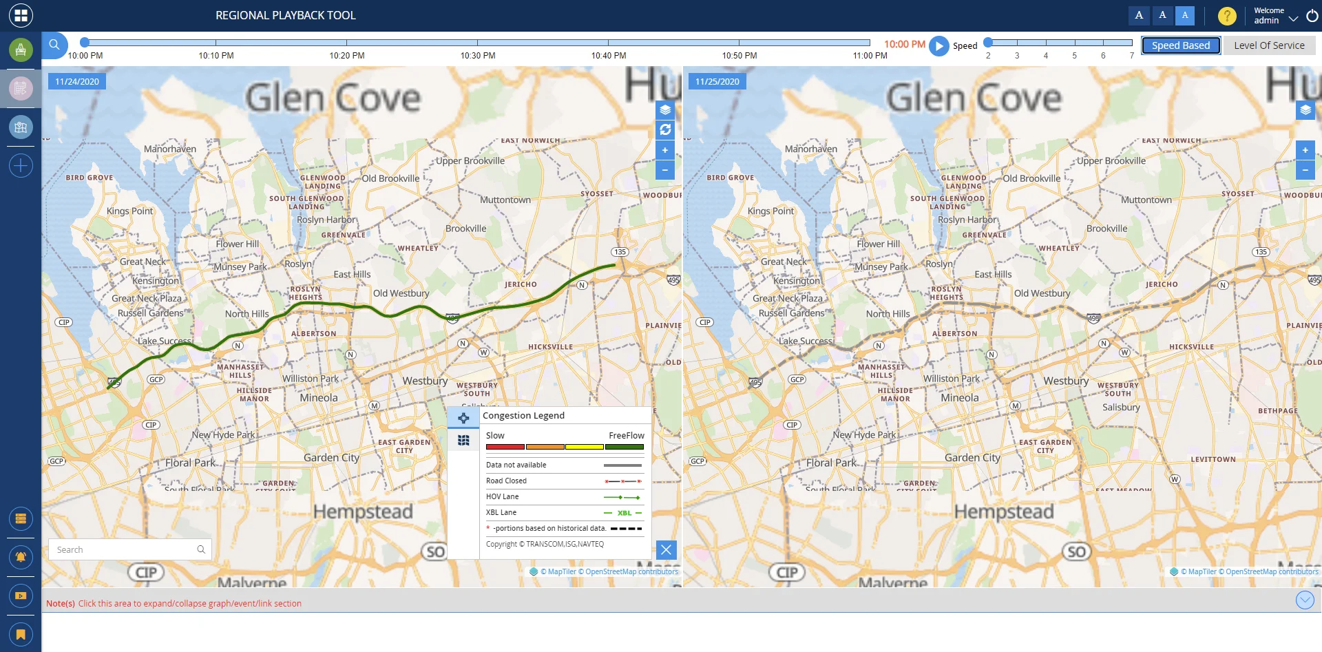
Regional Playback Tool
The Regional Playback Tool is an application which allows the user to view a play back of traffic congestion, incident and even weather conditions overlaid on the map.
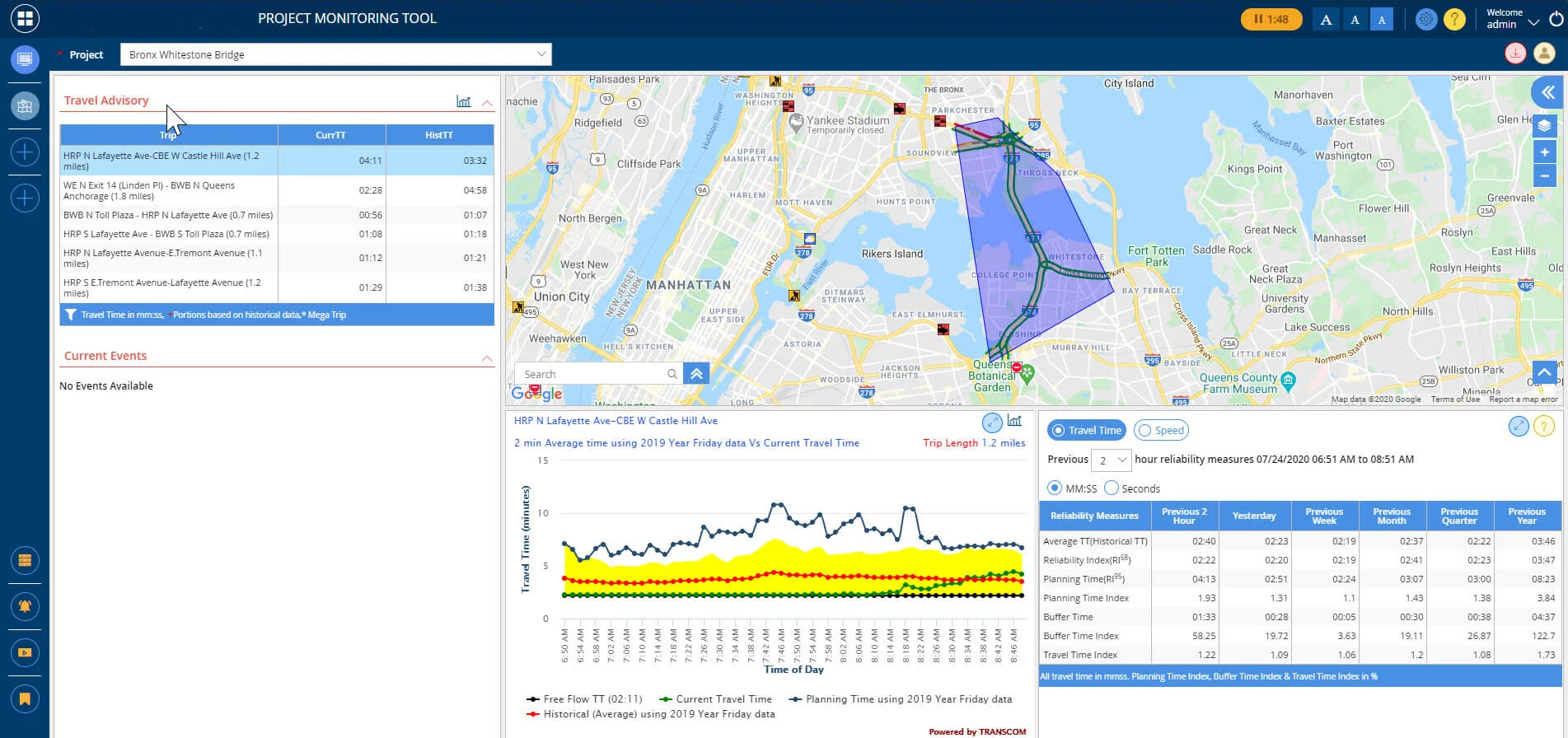
Project Viewer
The Project Viewer tool provides real time performance data for current conditions for Active Construction, Special Events or Long-Term Projects. It contains real-time, as well as, historical travel time information for trips. Specific trips can be monitored showing current and historical travel times, a list of active events, as well as, comparative charts for Reliability, Planning Buffer and Travel Time Indices.
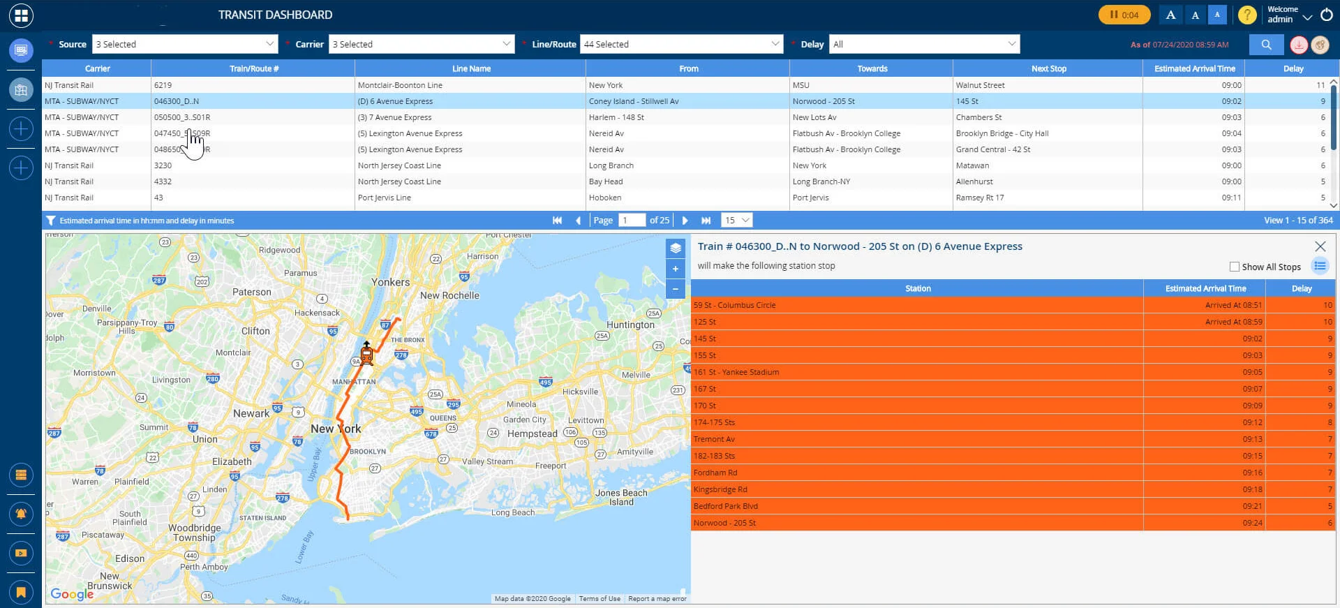
Transit Dashboard
The Transit Dashboard provides users with real time performance data for a set of specific rail lines, showing current operational conditions along these corridors.
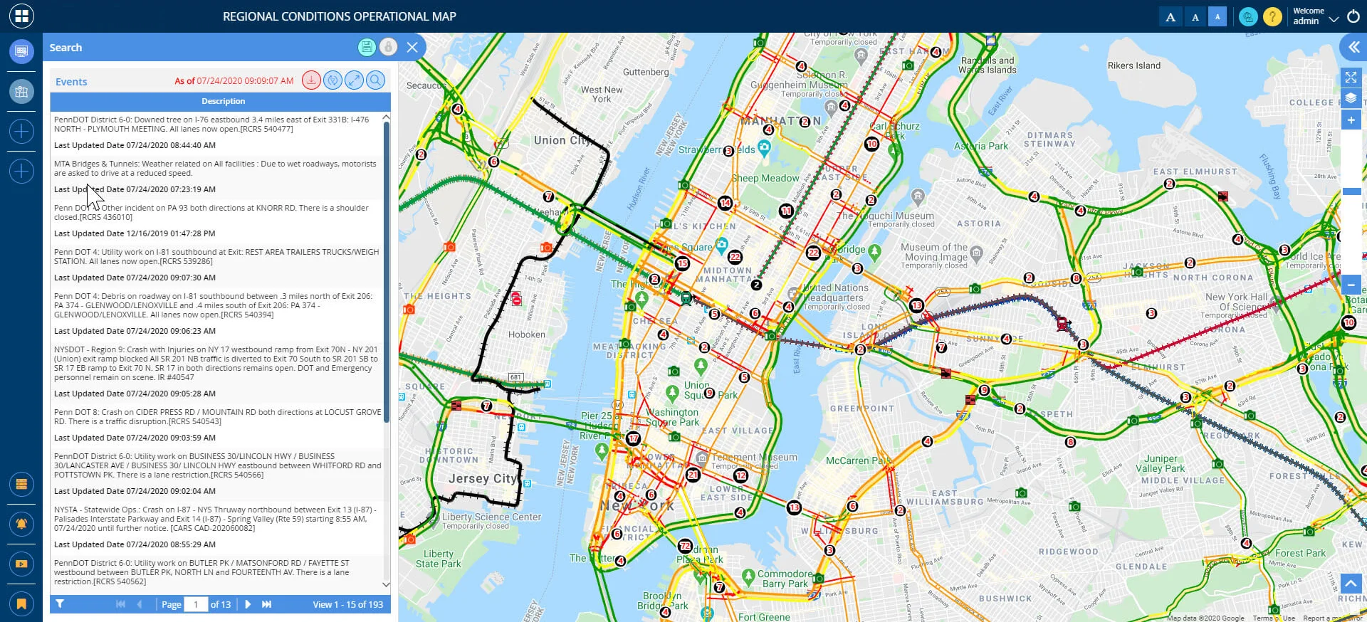
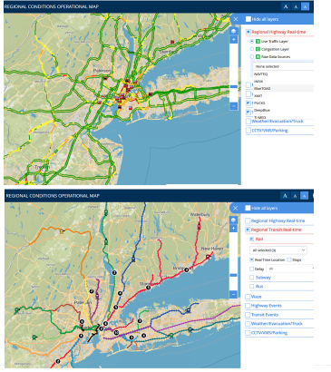
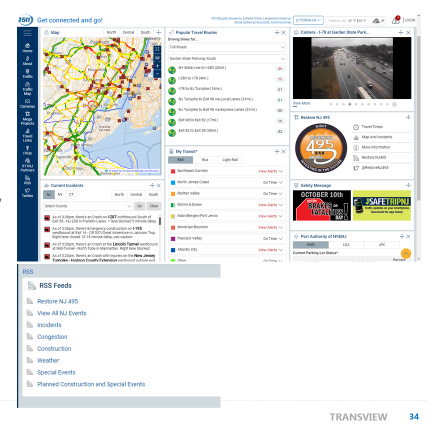
Regional Conditions Operational Map
The Operational Map provides information on roadway conditions, devices, incidents, construction, and other special events, as well as, transit incidents, in real time.
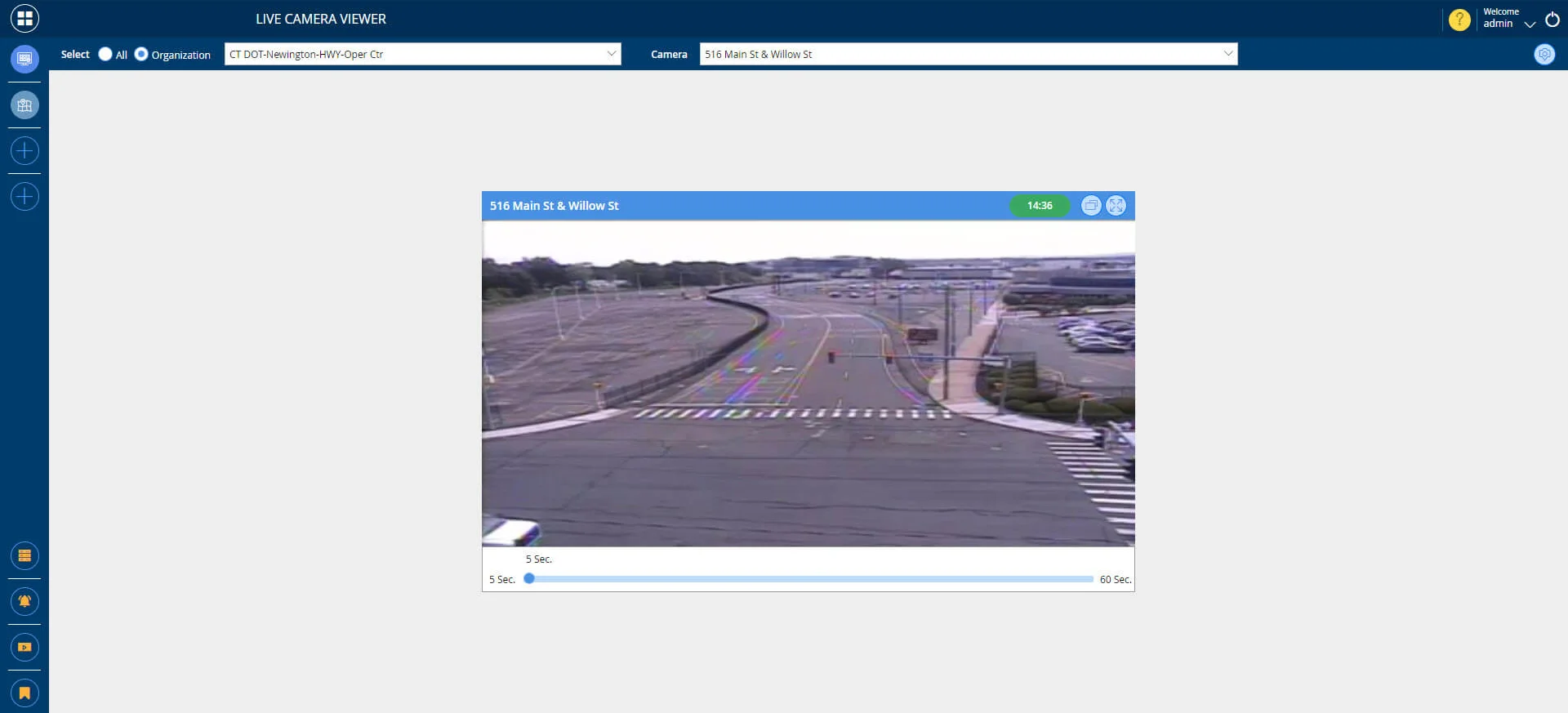
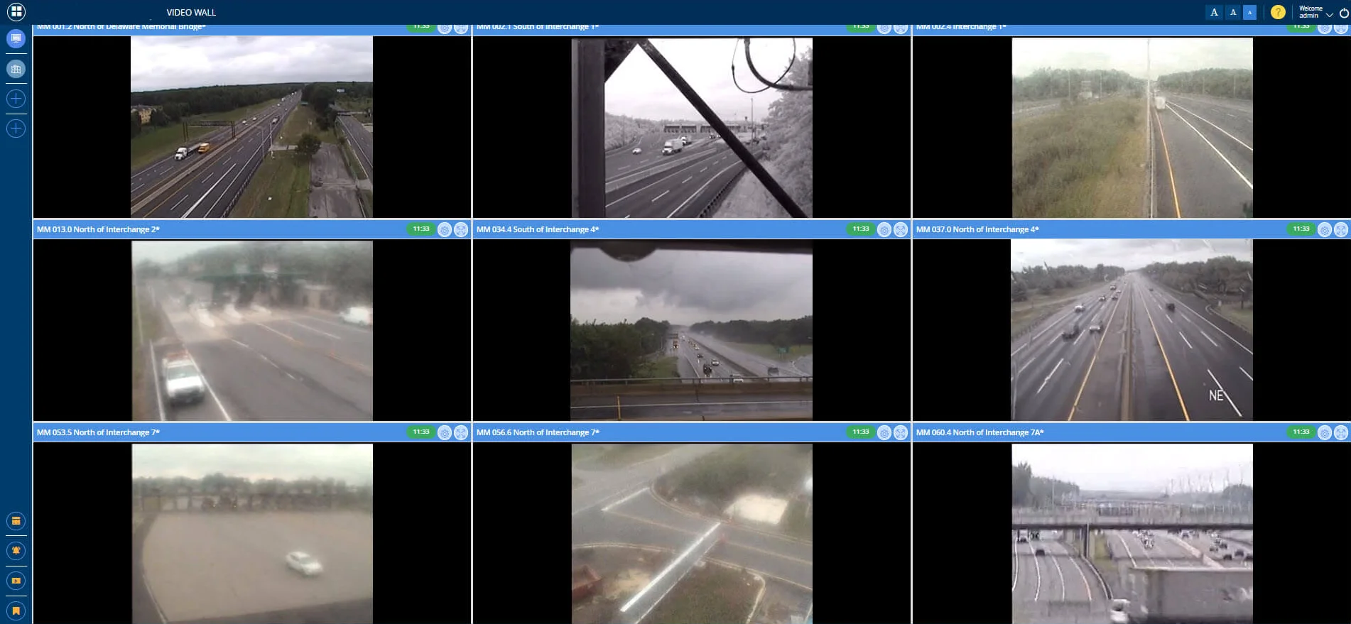
Video Wall Viewer
The Video Wall Viewer allows users to generate a video wall containing multiple CCTV feeds in one view.
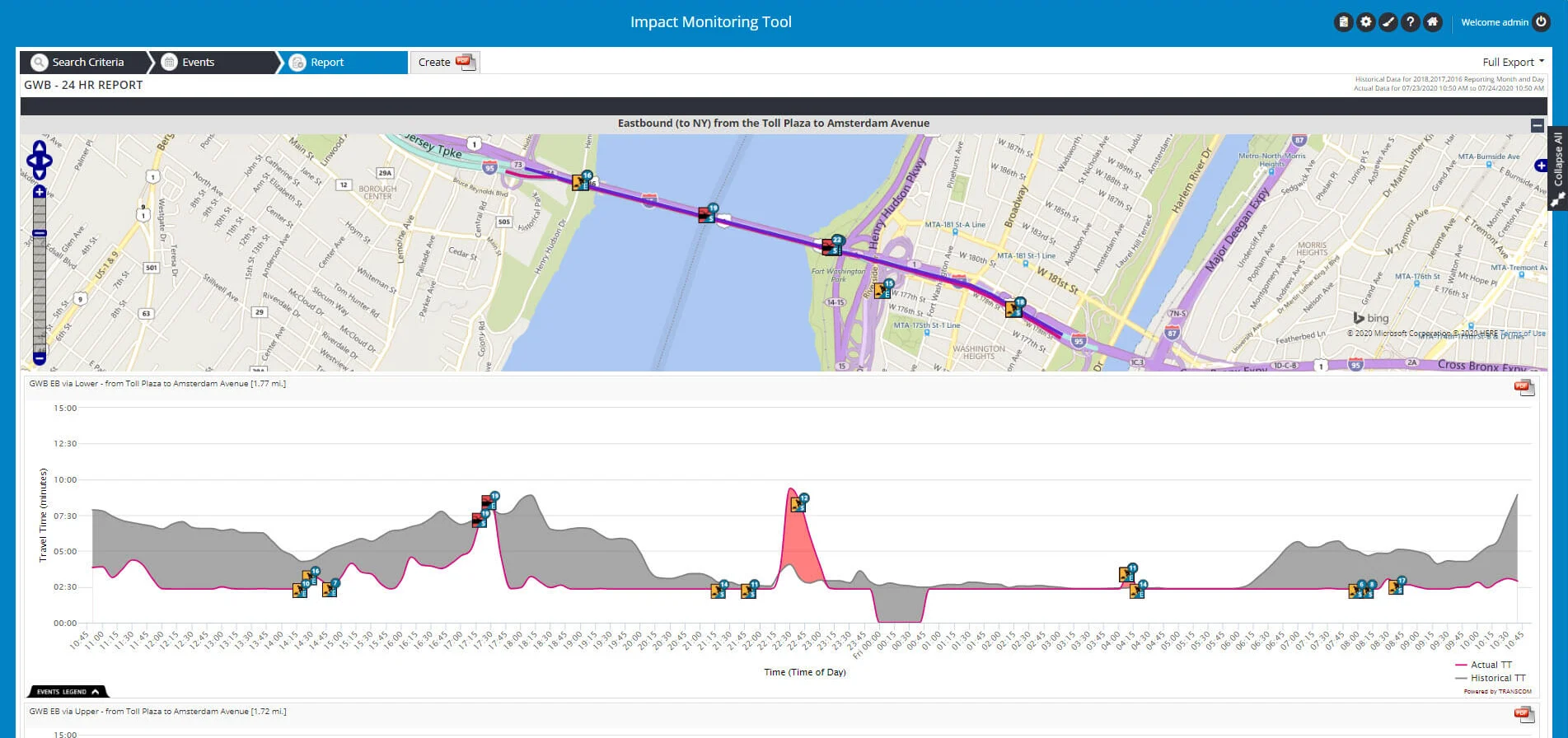
Impact Monitoring Tool
The Impact Monitoring Tool is a web-based application that was developed to provide an owning organization with the ability to easily configure, create and distribute a customized report that graphically presents information regarding incidents, construction, congestion and other ad hoc information. It also provides comparative travel times, in an easy to read format.
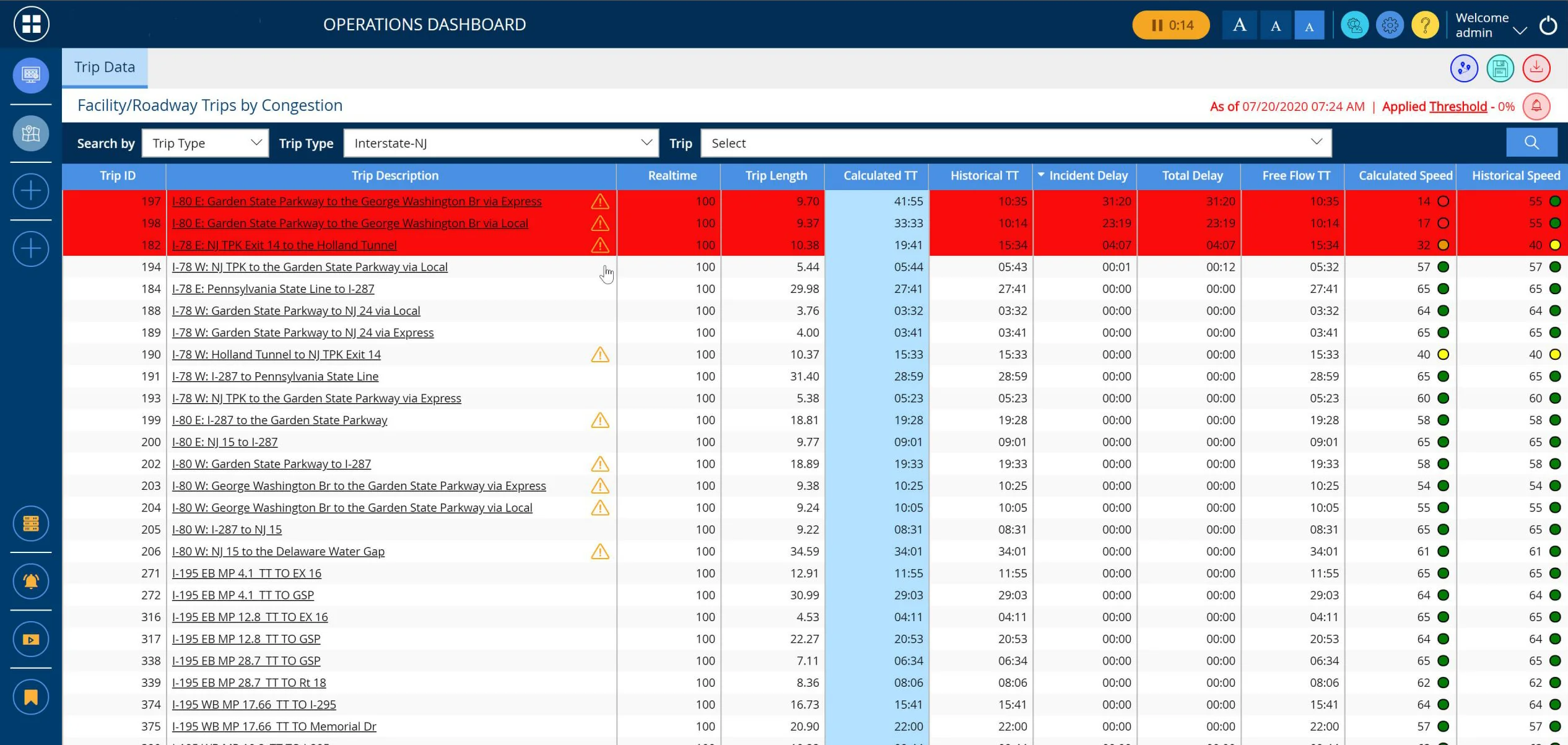
Operations Dashboard
The Operations Dashboard provides users with real time performance data for a set of specific trips, showing current operational conditions along these trips.
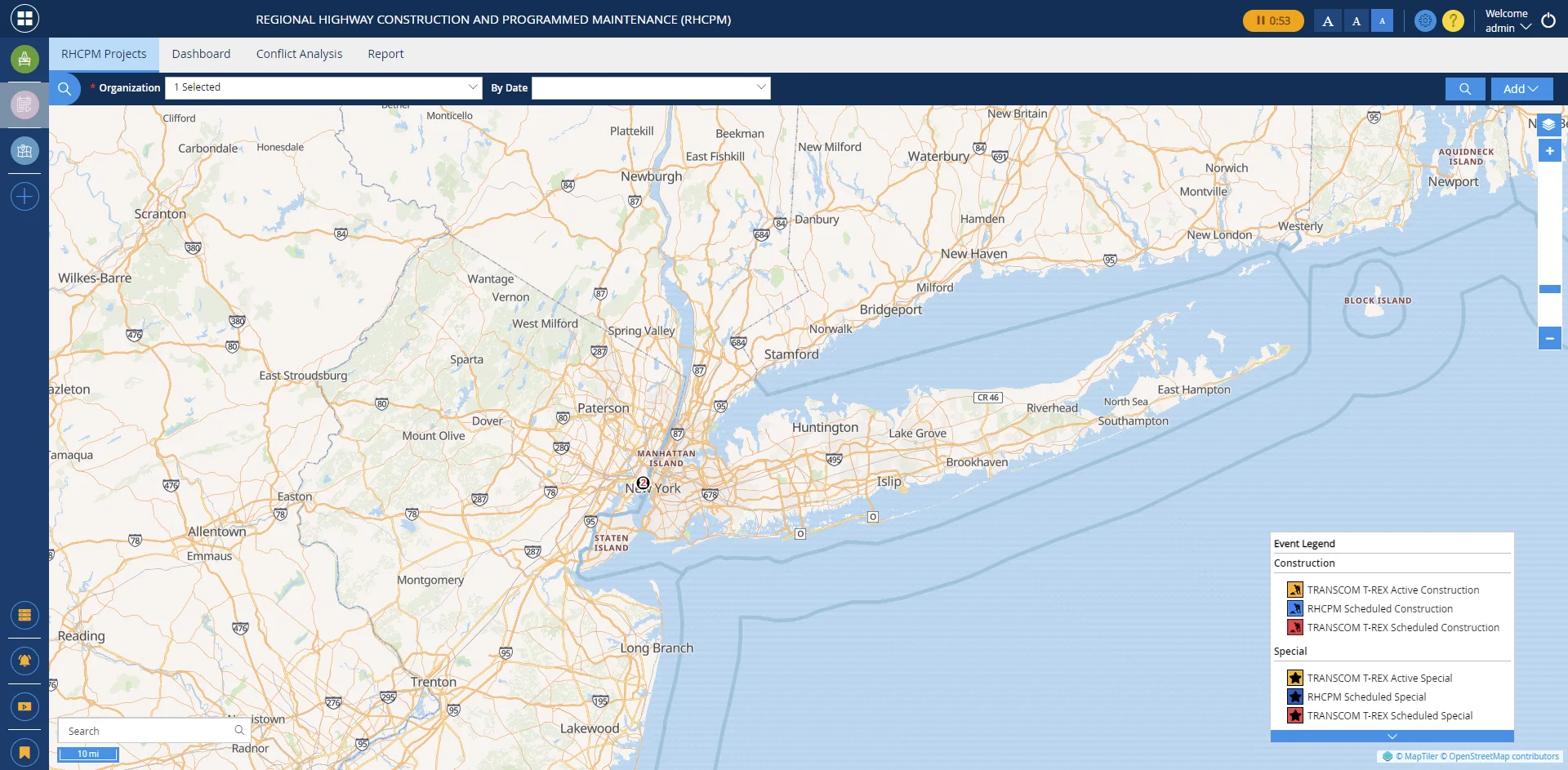
Construction (RHCPM)
The Regional Highway Construction and Programmed Maintenance (RHCPM) is a dashboard where a user can view planned or active construction which is about to initiate in the defined region. It is also an operational tool which provides travel time analytics specific to each major construction project and provides various filters that can be applied such as agency, facility, date/time, facility and scheduled hours.
Historical Travel Time Analysis Tool
The Historical Travel Time Analysis Tool allows the user to compare a specific travel time to the historical travel time. It also provides information on Planning time, Buffer time and Travel Time Indices
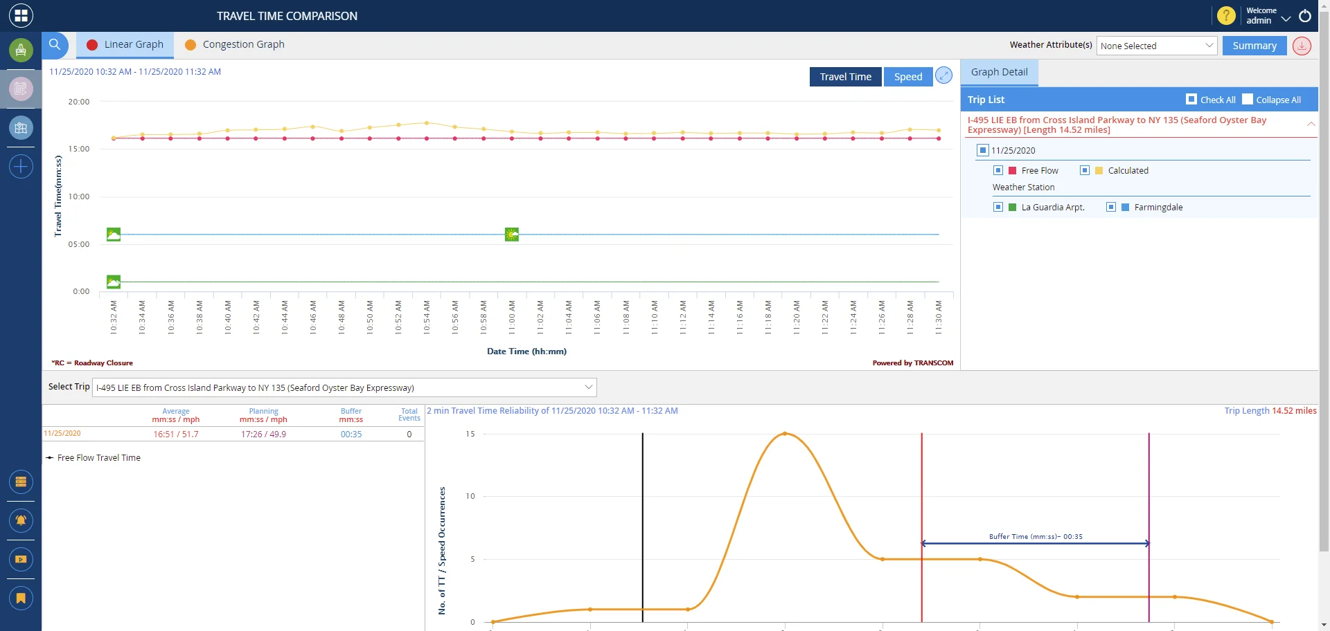
Travel Time Comparison
The Travel Time Comparison tool allows a user to view the impact on travel time(s) caused by an event, such as an incident, construction, or special event versus the historical travel time for each predefined trip(s)
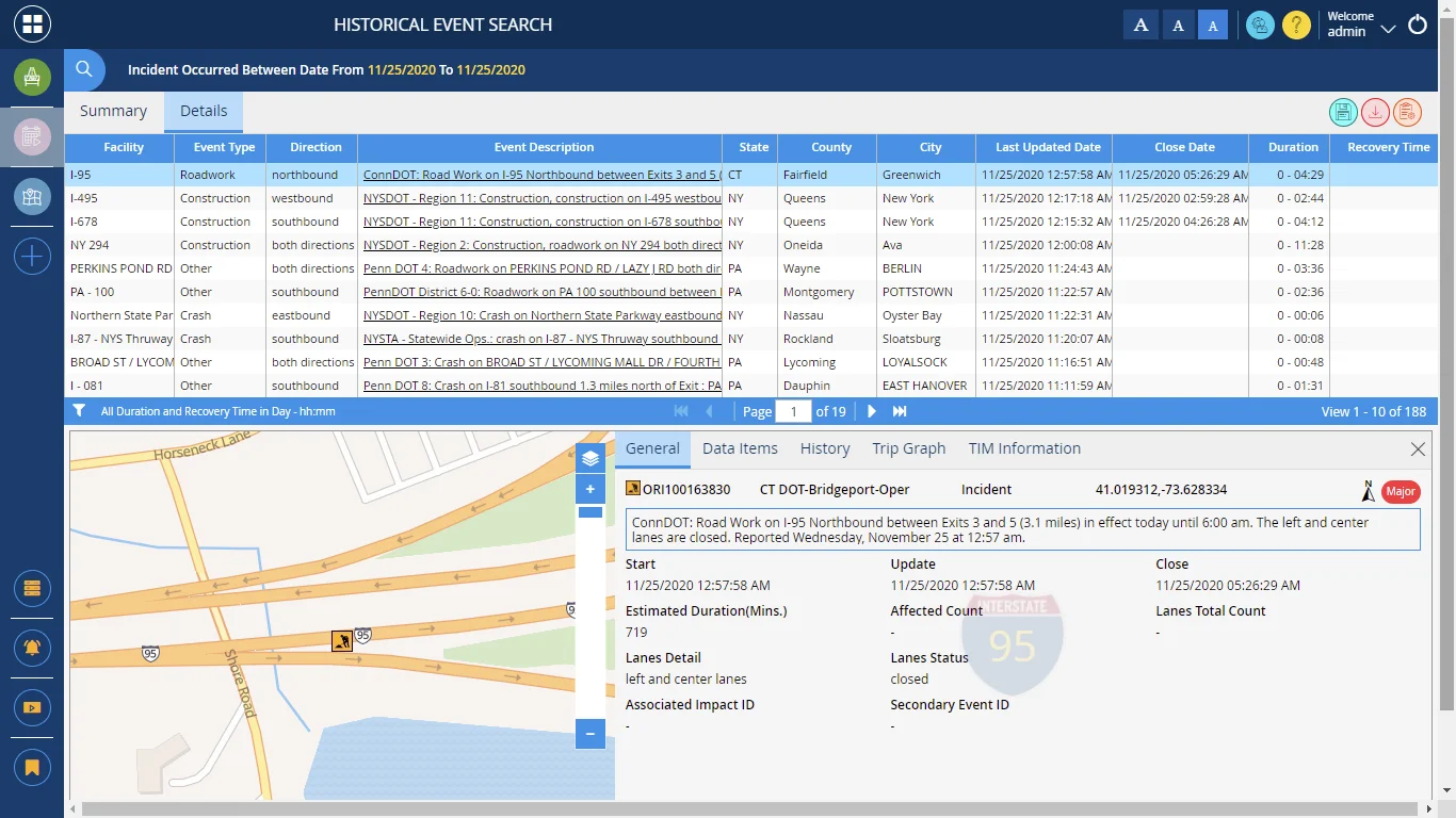
Historical Event Search
A comprehensive application that provides access to historical incident data. The Historical Event Search Tool can be used to develop high level and granular incident data queries as well as supporting charts and graphs
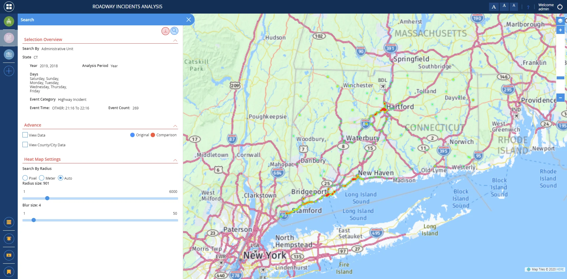
Roadway Incident Analysis
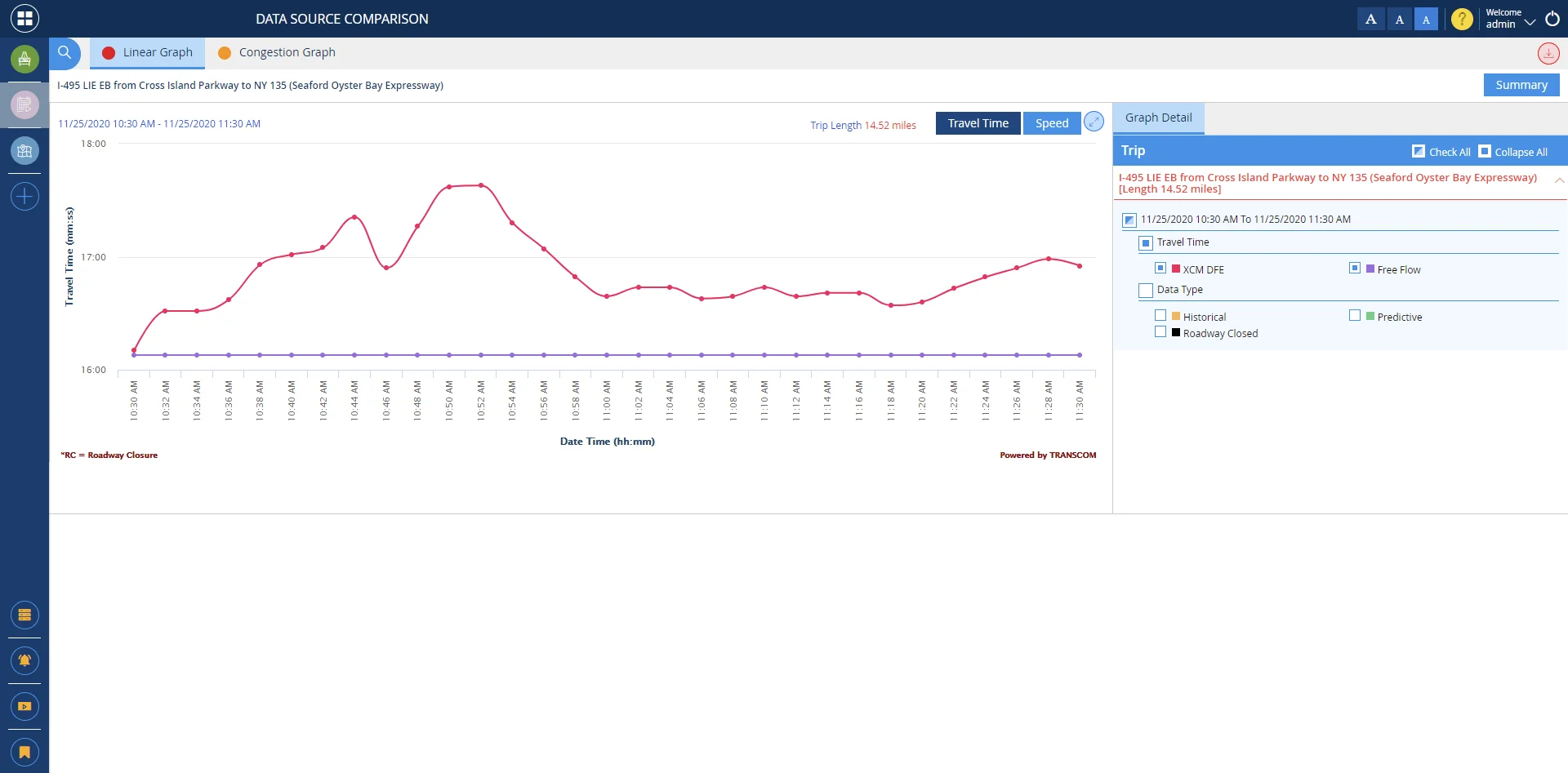
Data Source Comparison
The Data Source Comparison tool shows the travel times for a trip from all possible data sources available for that trip at a user selected time. This includes agency sources (TRANSMIT, Midtown-in-Motion), third party sources (INRIX or Navteq/HERE), different device sources (Bluetooth, Wi-Fi), and historical data.
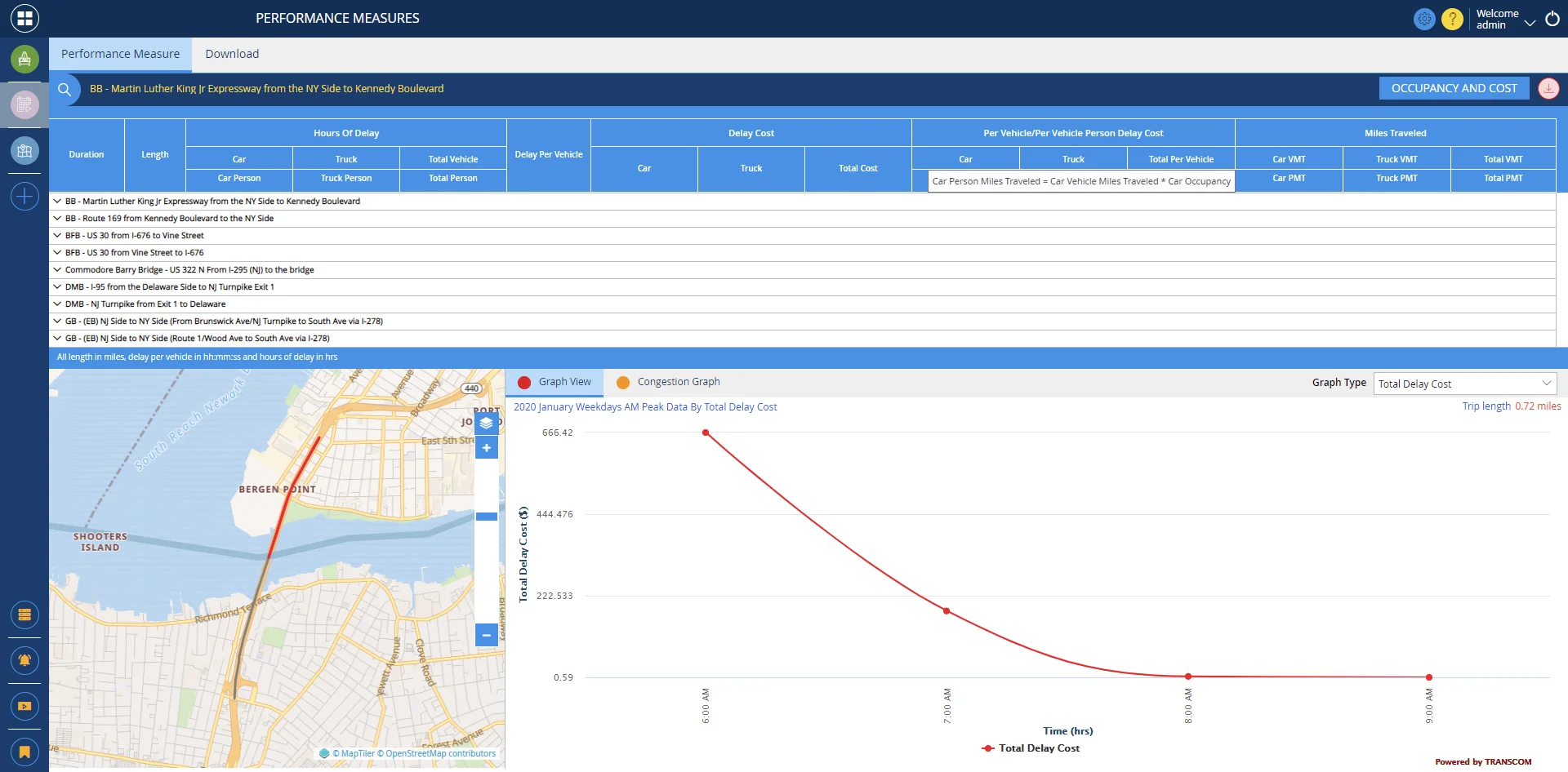
AASHTO Performance Measures
Performance Measures (AASHTO) application tool allows a user to analyze the cost impact due to delay occurrence for passenger and freight vehicles.
Impact Monitoring Tool
The Impact Monitoring Tool is a web-based application that was developed to provide an owning organization with the ability to easily configure, create and distribute a customized report that graphically presents information regarding incidents, construction, congestion and other ad hoc information. It also provides comparative travel times, in an easy to read format.

Construction (RHCPM)
The Regional Highway Construction and Programmed Maintenance (RHCPM) is a dashboard where a user can view planned or active construction which is about to initiate in the defined region. It is also an operational tool which provides travel time analytics specific to each major construction project and provides various filters that can be applied such as agency, facility, date/time, facility and scheduled hours.
Regional Playback Tool
The Regional Playback Tool is an application which allows the user to view a play back of traffic congestion, incident and even weather conditions overlaid on the map.
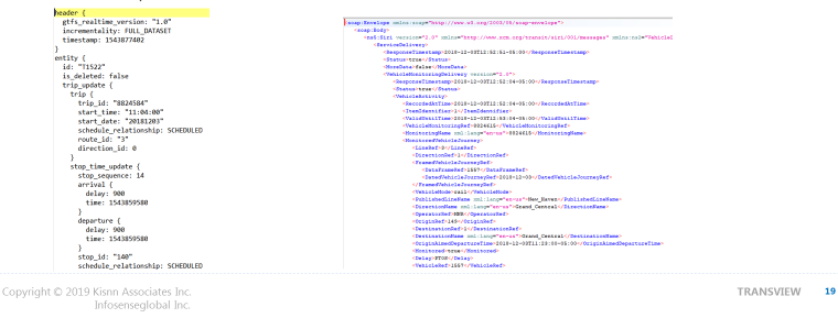
The TRANSVIEW Data Sharing Portal also allows transit agency users to subscribe to the real-time transit data via SOAP/REST protocols in GTFS-RT or SIRI formats. It also allows for subscriptions for transit schedule data in GTFS format.
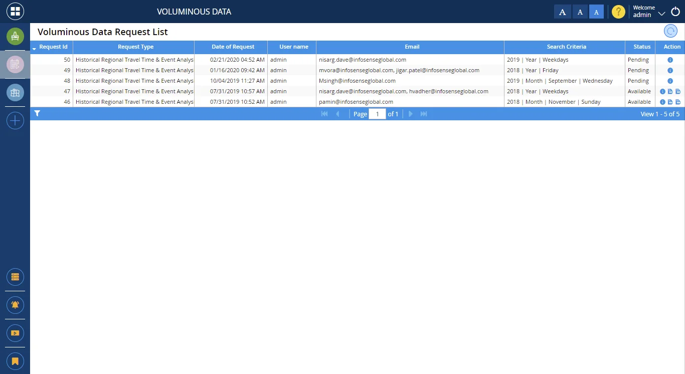
Voluminous Data
Voluminous Data is single page application that allows a user to request historical trip reliability information, or, TI-MED O-D Readers information in JSON format that a user can integrate with their existing GIS system.
The TRANSVIEW Travel Information portal features includes a public mobile friendly website, personalized alert system, integrated social media platform, and smart voice controlled intelligent personal assistant service (i.e. Amazon Echo – Alexa, Google Home, Apple SIRI and Microsoft Cortana).
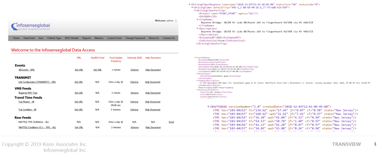
Data Sharing Portal – Real-Time data APIs
- XML, JSON, CSV, RSS, GeoRSS formats
- REST and SOAP (Pull/push)
- Supports various geometric formats for location information
- Lat/Lon, Linestring, GEOM, Multiline String
- API supports Real Time and Schedule event data, Travel Time by link, segment, TMC, Transportation Restriction data
- API supports agency operations (DMS), Traveler Information (511), agency initiatives (construction projects), research (university models), private sector (3rd party apps, employers and trucking industry (transportation restrictions)
Our Valuable Users
Our users vary from state departments of transportation to city and regional transit agencies.

New York State Thruway Authority

Metropolitan Transportation Authority

MTA New York City Transit

New Jersey Transit Corporation

MTA Bridges and Tunnels

New Jersey Department of Transportation

New Jersey State Police

Port Authority of New York and New Jersey

Connecticut Department of Transportation

New York City Police Department