Understand historical trip patterns and monitor travel conditions in near real-time


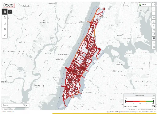
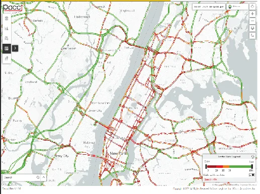
Live Speed Layer
Visualizing your roadway network with our Live Speed Layer will give your Operations Team an unprecedented look at how your roadway network is performing in near real-time.


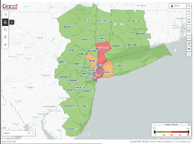
Origin and Destination (O/D)
With PACCT, obtaining accurate insights into the Origins and Destinations for trips is easier than ever. O/D data insights are available at the county, town, point of interest, or custom shapefile level.


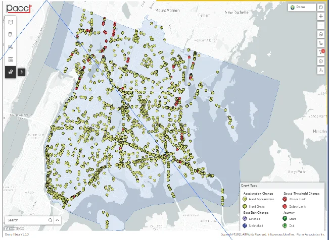
Trip Analytics
Transportation Planners can leverage PACCT to understand changes to mobility patterns, conduct before/after studies, and determine safety issues on the roadway network.
Turning Movement Counts
Traffic Engineers can view turning movement percentages and traffic flow maps within PACCT with just a few clicks. With a live feed of Connected Vehicle data, Turning Movements will be available in near-real time.